Land Use and Zoning Map

PROPERTY SEARCHFLOODPLAIN SEARCHLAND USE REGULATIONSHOME OCCUPATION REGULATIONS
Land use requirements in Woodbury County depend on several factors including the particular Zoning District a property is located in as well as if the property is within the Special Flood Hazard Area (SFHA) or floodplain. The Woodbury County Zoning Ordinance defines the Zoning Districts and regulations in Section 3.01 and the Floodplain Districts and regulations in Section 5.03. For more information about the floodplain regulations, visit the floodplain development page.
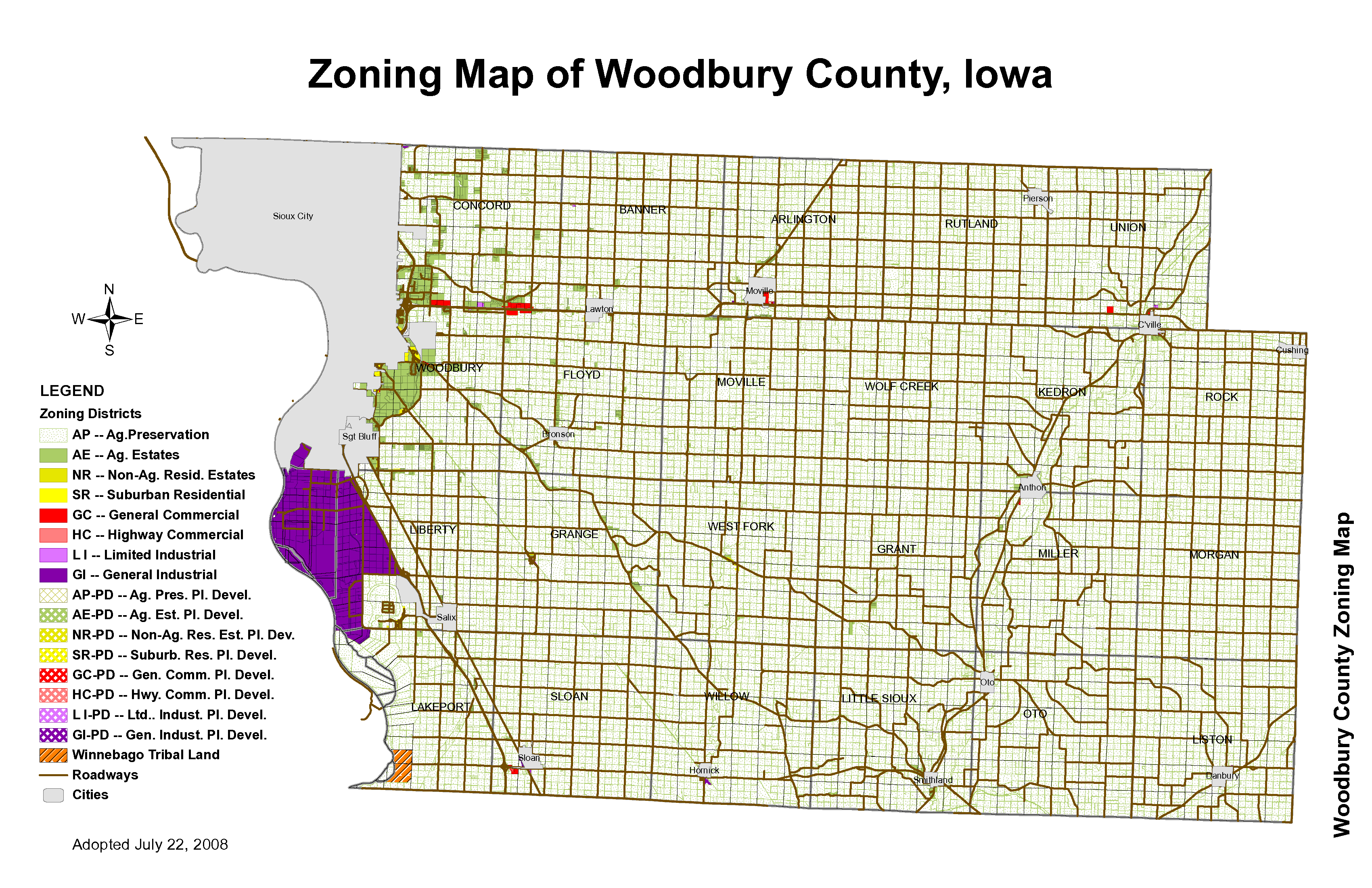
Below is a zoning map that illustrates the general location of each zoning district. Below the map, is a set of links to handouts that describe the land use requirements by zoning district.
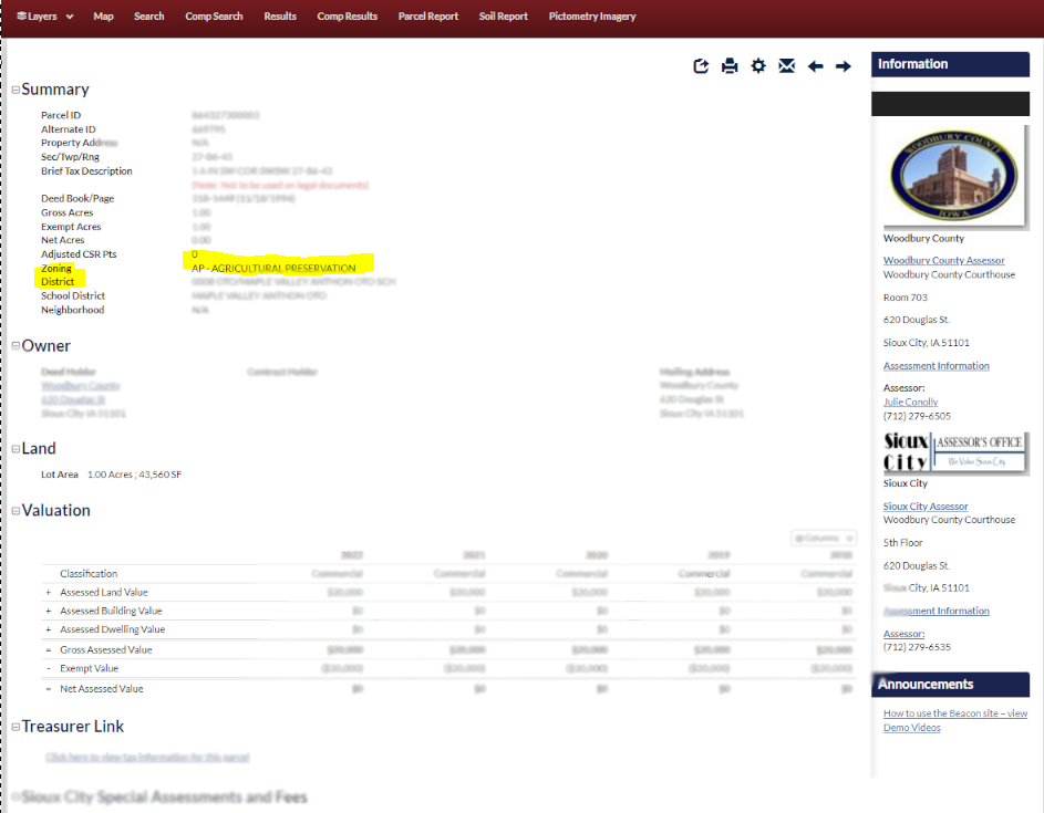
To specifically locate the zoning district in which your property is located, you may perform a "Property Search" on the Assessor's website (see example screenshot below). You may search for the property using the property owner's "name," "address," or other search options.
Once a property is identified, a "Parcel Report" page will appear (see example screenshot below). Under the first category, "Summary," look for the "Zoning District" option. To the right of this, you should see the Zoning District name (e.g. - "AP - Agricultural Preservation," "AE - Agricultural Estates, "SR - Suburban Residential, "GC - General Commercial", "LI - Limited Industrial," "GI - General Industrial," etc.).
LAND USE REQUIREMENTS BY ZONING DISTRICT
Agricultural Preservation (AP) Zoning District
-
Encourage the continued role of agriculture as the primary economic sector in the unincorporated areas of Woodbury County, thereby preserving its rural character. Land uses that are compatible with agriculture and farming are allowed. Soil and water conservation practices are encouraged.
Agricultural Estates (AE) Zoning District
-
Provide for a limited increase in the amount of small acreage development, including a controlled expansion of residential uses in appropriate locations throughout the county, in conformance with the County’s General Development Plan, and in a manner that is compatible with agricultural uses. It is intended that the development of residences be on platted lots including appropriate
limitations on uses as established by the owner/developer as part of the subdivision process
Surburban Residential (SR) Zoning District
-
Provide for orderly development of suburban density residential development in compliance with the County’s subdivision regulations. It is intended that development of residences would be platted in subdivisions for which the developer/owner has restricted the range of uses to the extent that no uses other than appropriate density residential and residential accessory uses are allowed
General Commercial (GC) Zoning District
-
The purpose is to provide for orderly development of limited commercial uses that are compatible with and serve the agricultural sector of rural Woodbury County
Limited Industrial (LI) Zoning District
-
Provide for the orderly development of heavy commercial, warehousing and limited industrial uses. Appropriate sites should have excellent infrastructure especially transportation access via highways
General Industrial (GI) Zoning District
-
Provide for the orderly development of heavy commercial, warehousing and limited industrial uses. Appropriate sites should have excellent infrastructure especially transportation access via highways


 Stay Connected with Our County